CLIMATIC DATA
For the purpose of this study, a total of 41 meteorological stations were selected, as can be observed in Table 1. From those, 13 were selected from the Climatic Research Unit (CRU) and 28 from the European Climate Assessment & Dataset project (ECA). Most of these stations were located in the Pyrenees, in addition to 6 stations located in lowlands of Catalonia Region and 1 station in Aragon Region (Figure 4). The selection was carried out aiming to cover most of the Catalan Pyrenees, as well as non-mountainous areas, to provide with wide range of elevations for the study.
The climatic variables selected for the analysis were mean annual temperature (MAT °C), annual accumulated precipitation (mm) and annual evapotranspiration (mm). The last two variables could help on understanding a possible negative water balance in the area of study.
The period 1970 - 2020 was selected for the analysis, as more data from precipitation and evapotranspiration from the meteorological stations of the study was available. However, the MAT data, for high elevation areas, in particular, presented gaps for the period selected. Therefore, only the period 2008 - 2020 was considered for the MAT analysis, taking into account the anomalies in MAT for the period 1981 - 2010, showed in the introduction section of this project.
The data series were obtained from the following databases:
- Climatic Research Unit (CRU) [3]
- European Climate Assessment & Dataset project (ECA) [11]
- National Center for Atmospheric Research (NCAR) [9]
- OPCC geoportal [8]
- A study by Castellanos-Acuna, D. and Hamman, A. (2019) [4]
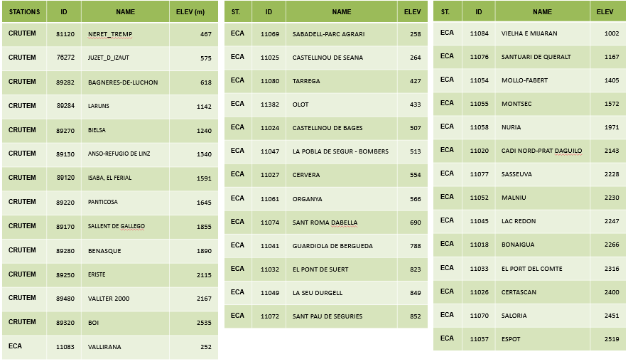
Table 1: Meteorological stations used for this study. Station source, ID, name and elevation (m) are represented.

Figure 4: Meteorological stations used for this study. The Catalonia Region and the Pyrenees mountain range are also delimited. Map created using QGIS.
